- +92 300 8208578
- +92 333 5558584
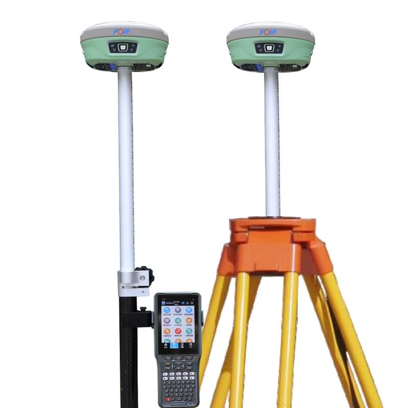
| Specification | Details |
|---|---|
| Channels | 1408 |
| GNSS Signals Supported | B1,B2,B3, GPS: L1CA, L1P, L1C, L2P, L2C, L5 , GLOASS: G1, G2, P1, P2 GALILEO: E1BC, E5a, E5b |
| Static | H: (±2.5mm + 0.1ppm), V: 5mm+1ppm |
| RTK | (±8 mm +1ppm), V: 15mm+1ppm |
| DGNSS | <0.5m |
| ATLAS | 8cm |
| Operating System | Linux |
| Memory | 8GB, Support Micro SD |
| Protocol | Support GeoTalk, SATEL, PCC-GMSK, TrimTalk, TrimMark, South,hi target |
| Network | 4G-LTE, TE-SCDMA, CDMA(EVDO 2000), WCDMA, GSM(GPRS) |
| UHF | Tx/Rx Internal Radio, 1W/2W adjustable, radio support 410-470Mhz |
| Operating Temperature | -35°C to +65°C |
| Weight | 1.2kg |
| Battery Capacity | 7.2V, (standard two batteries) |
| Battery Time | static Survey : 15hours, Rover RTK Survey: 12h |
The FOIF GPS GNSS A-90 is Embedded with high-sensitivity GNSS module , A90 can implement massive surveys: RTK, DGPS, (SBAS) , Static, etc. Carlson SurvCE/FieldGenius/Esurvey/SurPAD Surpad Software Professional,intuitive and efficient This RTK data controller Field Software is designed & developped by the most professional software R&D engineers team, which brings you a professional, intuitive and efficient measurement of the new experience. The ESurvey software integrates construction survey, power survey, GIS data collecting in one unit. This software is compatible both with Windows Mobile and Android platform, it also supports the smart phone to be used as data controller. 1. Power Survey Line selection, cross measurement, 4-D Data Format output. 2. Road survey Road design, Middle Side Stake Layout, Cross section survey. 3. Base Map Loading Support vector data loading such as DXF, SHP and GCP. 4. GIS collection Support Attribute Data Collecting by Self-Defined data dictionary and export GIS exchange format. 5. Post Processing Software GGO Support to convert the data format into RINEX, which is compatible with AutoCAD and other Drawing & Mapping Software.
Proudly collaborating with these exceptional brands